A Bird’s-Eye View of Our System: Learn More About Versant Power’s Aerial Inspection Program
Twice each year, a helicopter lifts off from Bangor carrying a small Versant Power crew on a mission most customers never see, but one that plays an important role in keeping the lights on across northern and eastern Maine.
From the rocky coastline of Downeast Maine to the forests of Aroostook County, Versant Power’s Aerial Inspection Program helps identify potential issues along hundreds of miles of transmission lines before they can become larger problems.
Led by Versant Power’s Asset Management team, the program combines experienced line inspectors, advanced imaging technology, and aerial access to some of the most remote terrain in the company’s service territory.
“We’re essentially getting a bird’s-eye view of the system,” said John Apperson, Lead Line Inspector for transmission and distribution at Versant Power. “Some of these lines run through dense woods, wetlands, mountains, and areas that are extremely difficult to access on foot. The helicopter allows us to inspect large portions of the system quickly and safely.”
Covering Hundreds of Miles in Just Days
The inspections are performed twice a year. Once in the spring or summer, and again in the fall or winter after leaves have dropped from the trees, improving visibility of the lines and equipment.
During a typical four-day patrol, crews inspect transmission infrastructure stretching across Hancock, Washington, Penobscot, Piscataquis, and Aroostook counties. Routes can include everything from coastal communities and blueberry barrens to remote forestland near the Canadian border.
On some days alone, crews may cover nearly 300 miles of transmission right-of-way.
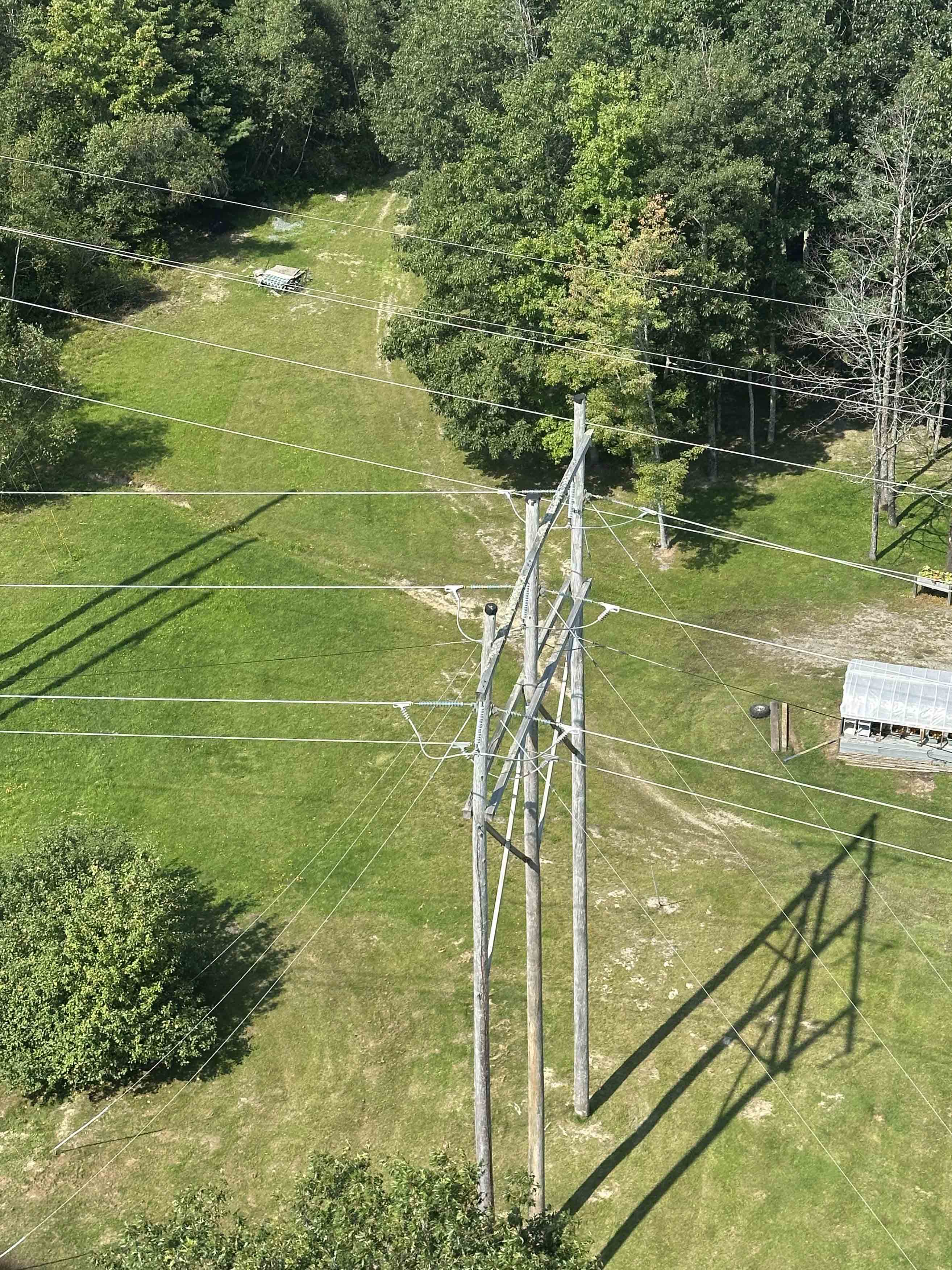
Inside the helicopter, the crew works in constant communication. One inspector helps navigate and identify issues while another operates infrared imaging equipment, documents findings, and logs locations in real time. The helicopter typically flies just 50 to 100 feet above pole tops, allowing inspectors to closely examine equipment that would otherwise take days to access from the ground.
Finding Problems Before They Cause Outages
Inspectors look for damaged or aging components, vegetation concerns, or signs of overheating that may not be visible from the ground. Infrared cameras help crews detect hot spots and equipment issues while the system remains energized.
“When we’re up there, we’re focused on finding anything that could become a larger issue,” Apperson said. “Sometimes we identify conditions that need immediate attention, and we can quickly get that information to our operations teams so repairs can be made safely and efficiently.”
The inspections also improve safety for field crews by allowing teams to better understand site conditions before traveling into remote areas.
“Technology has changed the way we do this work,” Apperson said. “We can provide crews with photos and information about what they’re heading into before they even arrive on site.”
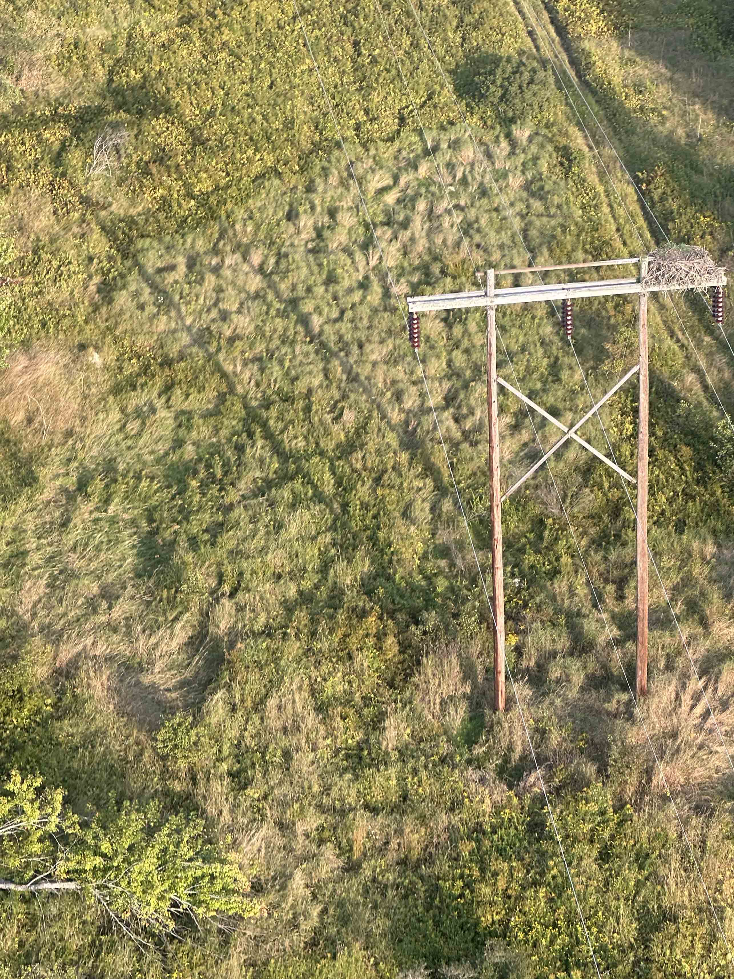
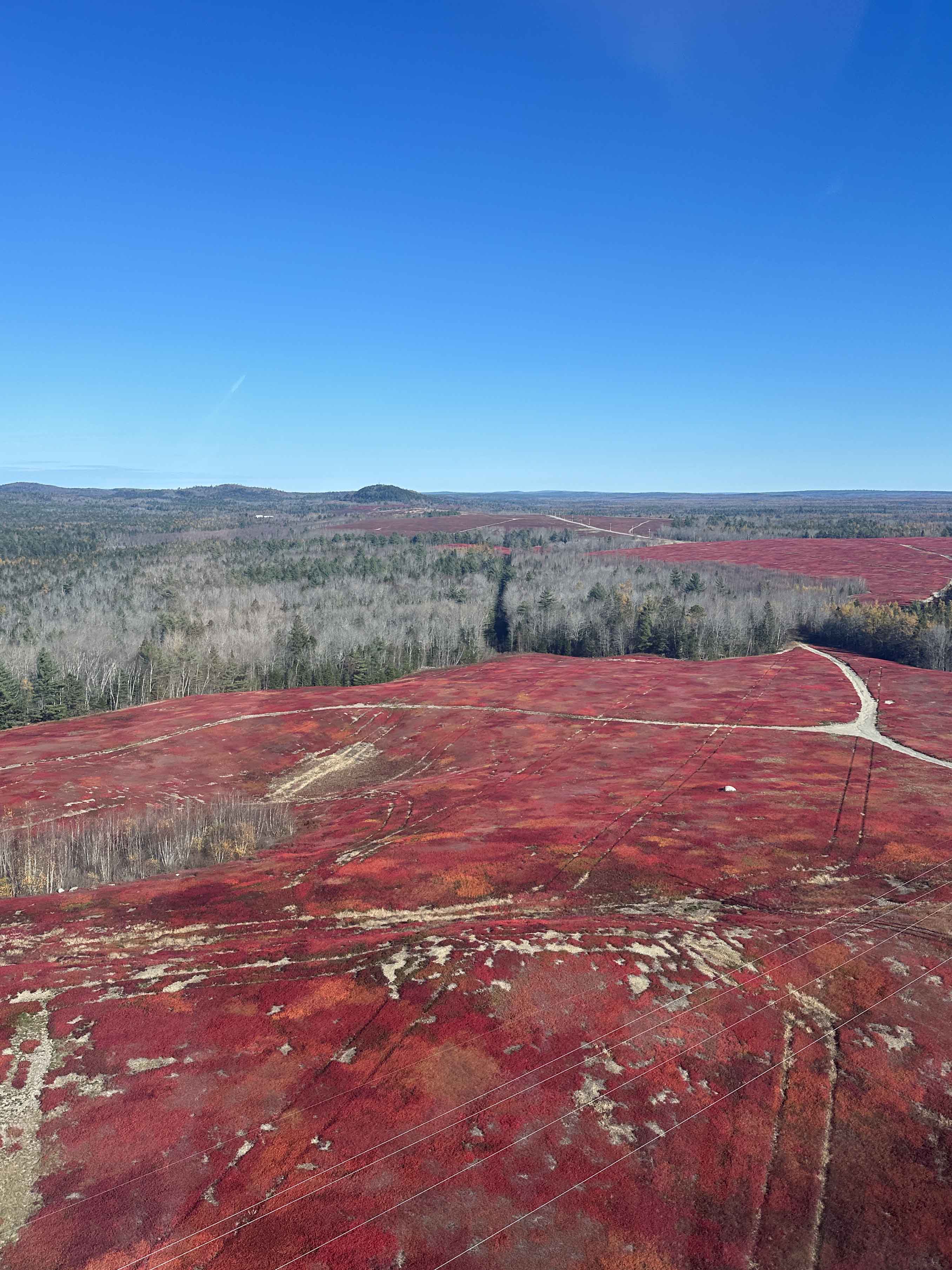
Left: H-frame structure with an osprey nest in Hancock County. Right: Blueberry barrens near Cherryfield.
Supporting Storm Response
The aerial inspection program also becomes an important tool during storm restoration efforts.
After major weather events, helicopters or drones may be deployed to quickly locate damage along transmission lines in hard-to-reach areas. In some cases, what might take an ATV crew an entire day to locate on the ground can be identified from the air in a matter of hours.
That speed helps restoration crews prioritize repairs and safely restore power to customers more efficiently.
A Unique Perspective on Maine
While the work is highly technical, Apperson says one of the most rewarding parts of the job is seeing Maine from above.
Crews frequently spot moose, deer, eagles, and ospreys during flights. They also witness some of Maine’s most striking landscapes — from bright red blueberry fields in the fall to the rugged Downeast coastline and deep North Woods.
“You really get to see how connected everything is,” Apperson said. “The roads, the forests, the communities, the coast. It gives you a whole new appreciation for the area we serve.”
For Apperson, who also serves as one of Versant Power’s drone pilots, the work blends technology, problem-solving, and a deep sense of purpose.
“You have to stay focused because the work matters,” he said. “At the end of the day, it’s about helping keep the system safe and reliable for our customers.”
Versant Power is committed to delivering safe, reliable electric service. As the state's second-largest electric utility, the company delivers electricity to more than 165,000 residential, commercial and industrial customers across 10,400 square miles in northern and eastern Maine.